On Friday, my husband and I took off work and drove about two hours north to the Piedmont/ Blue Ridge region of the Appalachian mountains.
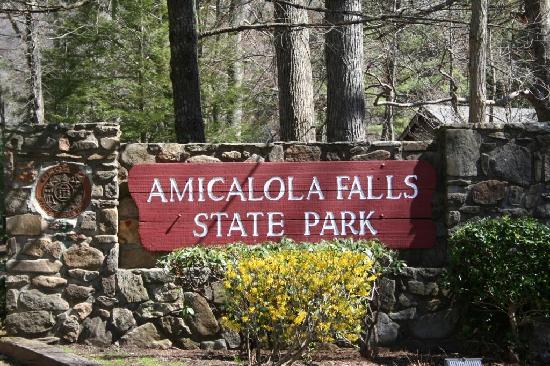 Our first stop was Amicalola Falls State Park in Dawsonville, GA. We had two objectives here: (1) hike down and then back up the (alleged) 600 steps along the waterfall ravine, and (2) find the geocache hidden near the lodge.
[About geocaching: Some friends of ours (I'll call them S & S) are big-time into geocaching, driving around all day with a handheld GPS, hunting down hidden caches by their coordinates, logging in, moving on to the next one. They were the ones who finally convinced us to try geocaching by lending us their little Garmin GPS. Here's what it's all about.]
The Georgia State Parks has a Geo-Challenge, which states if you find all 42 caches hidden in that many parks and historic sites, and stamp your PassPort with that park's unique stamp, you get geo-coins! A bronze coin for 15 caches, silver for 30, and gold for 40. Since we enjoy (and need an excuse) to hike in parks anyway, these are the caches we'll do, rather than those hidden in people's yards or in parking lots. We'll save those for days we're really bored.
So first we hiked the falls. We are also part of the Georgia Canyon Climbers Club, which means if we hike all four state parks that take part in this club, we get bragging rights. Oh yeah, and a t-shirt. (We're really not suckers for kitschy prizes, I promise!)
We parked at the top of the falls, climbed down about 425 steps to see this:
 |
| Amicalola Falls |
From the bridge straddling the falls, we enjoyed the cool breeze and a chance to stretch our legs. (Going down stairs is a lot harder than you would think! Especially if you're nearing 30.) Andrew took lots of pictures with his classic "continuous shot" technique, so the above picture is one of 20 that look almost identical. While we were there, our GPS caught enough satellites to coordinate our position. Apparently a basic handheld GPS doesn't work very well under tree cover, but once we'd been on the bridge for a while it finally locked on. So, satisfied that we had a few good pictures and that the GPS worked, we trudged on. Down 175 more steps and a long downhill path to a reflection pond.
 |
| Friendly nature-people pic |
At the pond, Andrew apologetically fielded a work call (we needed another rest anyway), then we headed back to the top. I claimed we couldn't really call ourselves "canyon climbers" unless we actually went up in elevation. Right? I found that I much prefer going up than going down. I'd rather get a cardiovascular workout than have creaky knees and rubbery calves and quads. But that's just me.
From there we drove over to the park lodge. The description said the cache was hidden about 60 feet off a short, easy trail loop nearby. Using the GPS coordinates we found the closest point along the trail. "Sixty feet? I thought we weren't supposed to go off the trail!" I said. All along our hikes so far were signs saying basically,
"Leave trail at your own risk."
"Stay on the trails for your own safety."
"It is against the law to leave the trail."
Well, it didn't really say that last bit, but the young-Hermione-Granger part of me believed it was reckless and unfair to invite geocachers to wander around the underbrush of the forest trying to find an ammo box with a bunch of trinkets inside. Also, you've gotta understand, I'm a nature-loving city girl who incidentally HATES catching a spider web in the face and is paranoid of getting a tick.
 |
| our first cache! |
After a hiatus in civilization for some wine-tasting at Wolf Mountain Winery (they didn't card me--another indication I'm clearly nearing 30) and yummy pizza at Gustavo's in Dahlonega, we drove to Vogel State Park to fit one more cache in our day.
 |
| grapes! |
 |
| giant veggie slice |

From the trail, I veered onto what looked like the same kind of footpath that led to the last geocache. We looked around there, but not knowing whether we were anywhere even close to the location, we kept going.
Near the highest point of the trail was a sort of camp circle with benches and logs, and we thought for sure the cache had to be there! The GPS even picked up enough satellites to tell us we were 50-some feet from the coordinates of the cache. We spent probably 20-30 minutes absorbed in the following activities: looking around the kumbaya circle, then continuing on the trail, then determining that doing so led us farther from the cache, and then retracing our steps to the kumbaya circle to look some more. Meanwhile, it's getting darker.
Finally, after resetting the GPS, we got a more accurate read that we were more like 100-some feet away. And we found that retracing the path the way we came in took us closer to the cache. But once again, as we descended the trail under more tree cover, we lost the signal.
.jpg) |
| centaurs might emerge from a dark forest |
When we finally left, it was nearly 8:00, mostly dark, and we were tired and thirsty. On our way out of the park Andrew said, "I bet that's the most harrowing, frustrating state park geocache we'll ever do." I hope he hasn't jinxed us.
That sounds like so much fun. I wonder if they have such a game in the Illinois State Parks.
ReplyDeleteHow many more parks do you have to visit?
This page has been removed!!
ReplyDeleteI wonder if Centennial Hill has a cache?????
ReplyDeleteThe link is back up!
ReplyDeletehttp://www.traillink.com/stateactivity/il-geocaching-trails.aspx